Market testing in Morocco

posted by cw on Thursday, December 30, 2010

As part of our series introducing you to the ViewRanger team, in this article we hand over to Ian Pond, who has recently joined the team full-time as Chief Marketing Officer (but who has been working with us for a couple of years in an advisory role). Ian comes to ViewRanger with deep experience of the mobile telecoms market including senior roles with Orange/France Telecom Group and more recently on a consulting basis including major assignments for TomTom, Truphone, and HTC.

Ian enjoys his outdoor activities and is a frequent surfer, fly fisherman, skier and occasional walker and biker. Following the recent launch of open maps on iPhone, here’s his road test...

Market testing in Morocco

My sports activities in the last few months of 2010 were severely curtailed following a biking accident in West Wales resulting in a broken left cavicle. So with field testing ruled out, the only option was some “market” testing around the labyrinthine souks of Marrakech with my wife.


Not surprisingly the OpenStreetMaps of Marrakech are not quite as detailed as those of a European capital, but proved quite sufficient to ensure that we never got lost.

Being an old hand in the mobile industry, I’m well aware of the eye watering mobile data charges that operators levy, especially when you go outside Europe. So job number one was to switch off roaming mobile data. It does mean that the GPS is a little slower in finding an initial signal, but that didn’t take too long on the roof terrace of our Riad.

I used the Wi-Fi at the hotel to view and cache the OSM mapping for all of central Marrakech and once happy that I had all the detail I needed, switched ViewRanger to off-line mode. From then on the app did its job perfectly, and tracked and recorded our wanderings through and round the covered markets and narrow back streets (see the screen grab). It allowed us to remain confident about where we were, to find Cafes and lunch stops and how to get back to the big square “Djemaa El Fna” and our Riad, without, importantly, incurring any roaming charges.


Fortunately the shoulder is well on the way to recovery now, and should be fine by February half-term for skiing and testing out OpenPisteMaps in Meribel. I just need to make sure I don’t fall on it again!

Labels:

Trusted by Enthusiasts: On the Pacific Northwest Trail

posted by cw on Thursday, December 02, 2010


Chris Townsend is a prolific outdoor writer and photographer with a passion for wilderness and mountains, and a penchant for long distance hikes. A four-time winner of Outdoor Writers' Guild Awards, he is the author of seventeen books, most illustrated with his own photographs, and he has co-authored and contributed to several more. Since 1991 he has been the Equipment Editor of TGO Magazine.

This past summer saw Chris head to the Pacific Northwest Trail, in the USA, with ViewRanger in hand loaded with National Geographic Topo! mapping.

Here’s what Chris had to tell us about his experience:

--------------------------------------

The Pacific Northwest Trail runs for 1200 miles from the Rocky Mountains to the Pacific Ocean in the northwest corner of the USA. Starting in Glacier National Park and finishing in Olympic National Park the PNT is a spectacular route in mostly wild and remote country, crossing several little-known and little-visited mountain ranges – the Selkirk Mountains, the Purcell Mountains and the Kettle River Range.

I walked the PNT over 75 days during the summer of 2010 and found it challenging and demanding. Often I walked for days without seeing another person, my only companions the wildlife – deer, moose, coyotes, eagles, grouse and, on three occasions, bears.

Calling the PNT a trail is misleading as there isn’t actually a clear path for much of the way and there are very few signposts. In fact, much of the route is on abandoned logging roads and disused trails that are fading back into the wilderness. There are some difficult cross-country sections too, both above timberline on exposed rocky terrain and in dense vegetation in the forests, where bushwhacking is the apt term for desperate struggles through the undergrowth.


[The Selkirk Mountains]


Navigation on the PNT is often difficult, whether it’s locating an overgrown trail, sorting out the right direction in a tangle of logging roads or keeping track of the direction when bushwhacking.

Having ViewRanger on my smartphone made all this much easier than it would have been with just map and compass. Being able to quickly locate my position on the screen map meant I could always keep track of where I was and know how to return to the correct route when the terrain had forced me away from it, as often happened when bushwhacking.

ViewRanger was particularly useful when I needed to find hidden trail junctions. These junctions were marked on the map but no longer existed on the ground. To find them I would walk with the smartphone in my hand, following the arrow until I reached the spot where the junction should be. There I would turn in the right direction and follow ViewRanger along the line of the route until the old trail appeared. I did this several times and every time I found the junction and soon afterwards the trail. Without ViewRanger this would have been extremely difficult.


Want to read more go to: http://www.tgomagazine.co.uk/blogs/backpacking-with-chris-townsend

or visit Chris' website at: http://www.christownsendoutdoors.com/

Labels:

Built by outdoor enthusiasts...

posted by cw on Monday, October 25, 2010

As you may have guessed, we're all outdoor enthusiasts here at ViewRanger. We are hillwalkers, sailors, cyclists, glider pilots, mountain bikers, kite-buggy racers, and more!

From time to time, we'll be introducing you to members of the ViewRanger team and welcoming guest blog posts from our team that say "I am ViewRanger". We're also keen to hear stories from ViewRanger users too - and hopefully we'll post some of those to this blog from time to time.

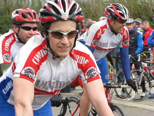
First up, is our cycling champion Eric. Whether it's on the road or in the velodrome, Eric is the fastest thing in the ViewRanger office on two wheels. The only thing he's faster at? Writing code for Android handsets.

IMG_1124

Hello – my name is Eric. I am one of the software engineers here at ViewRanger. I joined the ViewRanger team to help bring the ViewRanger experience to the Android mobile platform. We've taken some big steps forward and every day brings us closer to our goal of providing the full set of features on all our supported platforms.

In updates from me on our blog or Twitter and Facebook feeds, I'll be looking to highlight items of interest on the technical side of engineering ViewRanger GPS for Android, but I'll also try to put some of my other interests under the lamplight.

These include all manner of mobile, location-aware and communications-technology themes. I've been working on location-based software systems since the late 1990's, back when civilian GPS accuracy was measured in hundreds of metres and the Motorola Startac was the epitemy of cool.

But I'm also a competitive road and track racing cyclist and a some-times runner, with a keen interest in the integration of technology with these activities. I grew up hiking in the coastal mountain ranges of western Canada and still manage the odd ramble in the UK.

My 2010 road racing season finished off at the end of September. I had a steady year, with consistent results but no real stand out races. After a couple of weeks off it is time to start preparing for next year's season and aim to improve on that. I'll be planning and starting my 2011 training program in the coming weeks, which will coincide nicely with my ViewRanger development plan as I start to work on some more sports-orientated features. Stay tuned!

Also worth mentioning:

I will be at the Droidcon conference in London this Thursday & Friday (28th & 29th). Let us know if you will be there as well!

Labels: