
Northern Ireland Topo Maps and WalkNI Routes Now Available
posted by cw on Thursday, April 21, 2011We're really pleased to release Northern Ireland mapping and route content into the ViewRanger content library today.


Topo Maps
 We've worked with Ordnance Survey Northern Ireland to bring both 1:50,000 Discoverer maps and 1:25,000 scale Activity maps to ViewRanger.
The 1:50,000 maps are available to download direct to the handset as 10km x 10km map tiles; or as an "all" Northern Ireland region download (available in-app or through our webshop). These tiles work seamlessly with our existing Ordnance Survey Ireland maps - allowing a seamless map across the whole island.
The 1:25,000 activity maps are available to download as map regions in-app and through our webshop. Six regions are available: Causeway Coast, Glens of Antrim, Mournes, Lough Erne, Strangford Lough, and Sperrins. The digital maps, which cost just £7.99 each, exactly mirror the paper Activity Maps published by OSNI.
WalkNI Quality Walking Routes
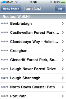
 To complement the OSNI mapping, we are working with WalkNI and CycleNI, in association with Northern Ireland Tourism Board, to bring you the best walking and cycling routes across Northern Ireland.
Today we've released 19 Quality medium length walks. These are available to browse and download through the ViewRanger app, and can be browsed on the new ViewRanger online community and trip planning website.
More to come...
With Northern Ireland Tourism Board we are working to bring you the best content to explore this country - so look out for more great routes and information to be published over the next few weeks.
posted by cw @ Thursday, April 21, 2011
1 Comments
![]()
1 Comments:
Loved it. Some really good points in there. Cheers, have a great day
Tiles Northern Ireland
Post a Comment
Subscribe to Post Comments [Atom]
<< Home